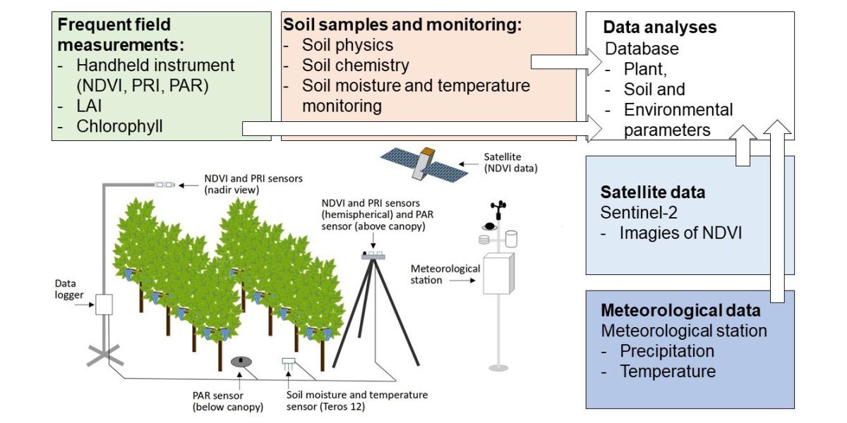
Methods enabling stakeholders for receiving information in a timely manner on plant stress in agricultural settings can help mitigate a possible decrease in plant productivity. In the framework of the OTKA 131792 project, periodic and monitoring soil and plant measurements are carried out on a small agriculturally dominated catchment in the Balaton-Uplands, where a comprehensive soil-plant-water system studies in different land-use areas are being conducted. Part of these data collections were the basis for a recent publication in the Land journal.
One of the main objectives of the published study was to investigate soil-plant interactions. To explore this, plant spectral information, soil chemical and physical data, and the relationship between soil moisture and temperature measurements were analyzed in sloping areas. In addition to the values collected during field measurements, satellite (Sentinel-2) data were used by validating and spatially extending the field data. This method can provide new directions and opportunities for a more accurate understanding of the soil-plant-water system.
Among the land use sites studied (one grassland, one cropland/maize, and three vineyards), grassland had the lowest mean values of normalized vegetation index (NDVI), fraction of absorbed photochemically active radiation (fAPAR), and leaf area index (LAI), which together indicated high water deficiency. Slope aspect significantly influenced NDVI, photochemical reflectance index (PRI) and fAPAR for both grassland and cropland (p < 0.05), while soil water content was significantly different for all three vineyard sites (p < 0.05). When soil physical and chemical parameters were compared with NDVI values, the strongest correlation was observed for the vineyard samples, while the highest correlation between the soil parameters studied and PRI values was observed for the grassland. Also a strong correlation (r = 0.761) was observed when comparing the measured and satellite retrieved NDVI values for the different land use types. The results of this study suggest that the incorporation of satellite-based NDVI data can greatly improve the reliability of field observations and also provide an opportunity to expand the research. The published study also draws attention to the close relationship between the soil-plant-water systems, where continuous monitoring can help develop site specific climate change mitigation methods.
Zsigmond, T., Braun, P.; Mészáros, J.; Waltner, I.; Horel, Á. (2022). Investigating plant response to soil characteristics and slope positions in a small catchment. Land, 11(6), 774. https://doi.org/10.3390/land11060774