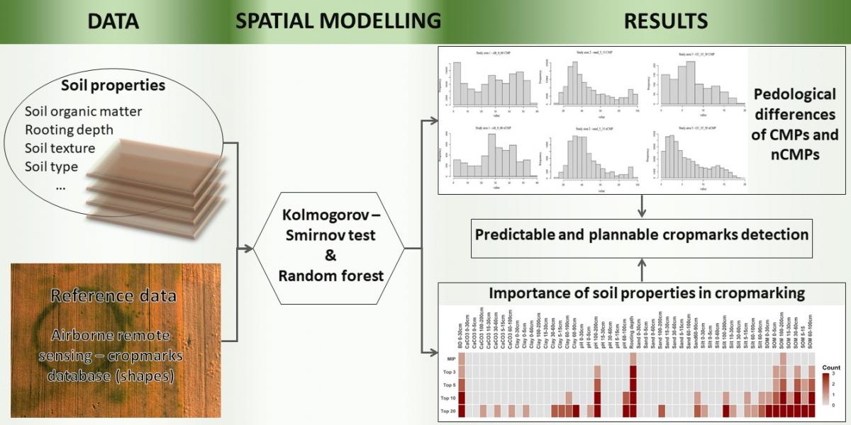
The colleagues of the Institute for Soil Sciences, in cooperation with the researchers of Eötvös Loránd University, developed a possible solution to the decades-long problem of aerial archaeology based on the Institute's soil data infrastructure. The characteristic surface forms (so-called cropmarks), which were visually detected from the aircraft and can be interpreted as an indication of the cultivated vegetation, were analyzed and their soil properties background was revealed in three study areas. In the analysis, the pedological background of the forms appearing in the vegetation was identified using classical statistical (Kolmogorov-Smirnov) and a new type of data mining (random forest) method, thus clarifying the spatial probability of the sites detected by aerial archaeology. The results were published in the highly regarded in earth sciences, D1-rated Remote Sensing journal (https://www.mdpi.com/2072-4292/13/6/1126).
More information:
Czajlik, Z., Árvai, M., Mészáros, J., Nagy, B., Rupnik, L., Pásztor, L. 2021. Cropmarks in Aerial Archaeology: New Lessons from an Old Story. Remote Sensing 13(6), 1126