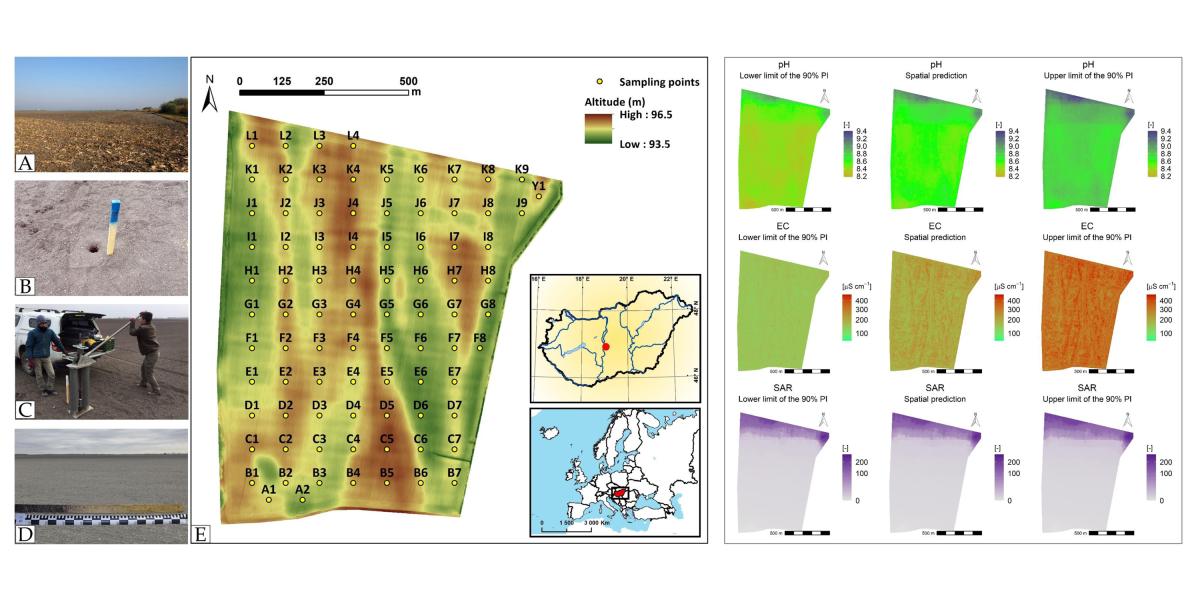
Researchers from the Department of Soil Mapping and Environmental Informatics, and the Department of Soil Chemistry and Material Turnover, collaborating with researchers from the Department of Landscape Protection and Environmental Geography, University of Debrecen, have studied the possibility of high-resolution mapping and assessment of salt-affectedness in a study area close to Dunavecse on 85 hectares. The research was funded by the National Research, Development and Innovation Office (NKFIH), grant number K-124290. Their results illustrated that ensemble machine learning combined with multivariate geostatistics could be a promising method not just for jointly modelling and mapping the spatial distribution of different indicators of salt-affected soils (e.g., pH, electrical conductivity and sodium adsorption ratio) at high spatial resolution but also in assessing salt-affectedness on arable lands at the field scale. Furthermore, their maps can help the land users to select the appropriate agrotechnical operation for improving soil quality and yield. Their results and findings have been published open access in Agronomy (Q1, IF: 3.949):